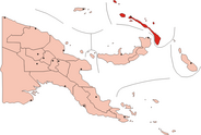
Tatau Island

Tatau Island is an island of the Tabar Group of Papua New Guinea, located to the east of New Ireland and about a mile south of Simberi Island.[1]
References[edit]
- ^ United States. Defense Mapping Agency. Hydrographic Center (1976). Sailing directions for the Pacific Islands, v.1--Western groups, including the Solomon Islands. Dept. of Defense, Defense Mapping Agency, Hydrographic Center. p. 197. Retrieved 31 December 2012.
2°47′S 151°58′E / 2.783°S 151.967°E
